Le col de la Sambie

Le col de la Sambie
Address
Parking à 300m de la sortie du village, direction Col de Tourniol
26300 BARBIÈRES
Contact
Languages spoken
- French
Parking à 300m de la sortie du village, direction Col de Tourniol
26300 BARBIÈRES
From the forests of the Col de la Sambie to the pastures of Les Artailles and Les Blaches, you'll enjoy this trail of good paths.
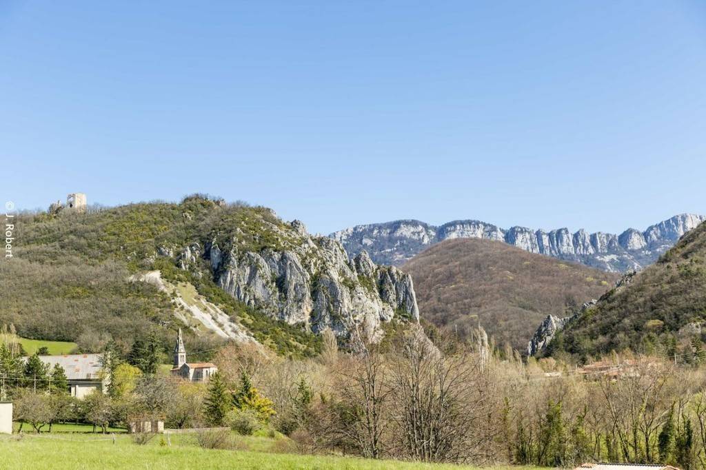
Le château de Pellafol
Le village de Barbières est dominé par la dentelle de pierre du château de Pellafol, dont il ne reste aujourd’hui que le donjon pentagonal. Fief appartenant à l’évêque de Valence, ce château de la fin du XIIe siècle dominait la partie haute de Barbières. La partie basse, elle, appartenait aux comtes de Valentinois.Au XVIe siècle, Antoine de Beaumont, seigneur de Barbières, fut connu sous le nom de « Capitaine Barbières ». Son château de Pellafol fut détruit en 1595. Une légende prétend que des souterrains le relient à des grottes dans lesquelles serait enfoui un trésor.
1/ Du parking, traverser par la route le torrent des Riveures. Derrière le calvaire, monter par le chemin de la Dame. Ignorer deux chemins à gauche, passer derrière une ferme et arriver sous une maison. Couper la piste pour continuer tout droit sur le sentier. Cheminer dans les pâtures avant de redescendre légèrement et atteindre la route; l\'emprunter à gauche.
Coordonnées: (44.951473, 5.1451627)
Distance depuis le point de départ: 12 m
2/ Passer devant une habitation : la route cède la place à un chemin. Continuer à gravir la pente en prolongeant par un chemin de terre. Après la dernière masure, l\'itinéraire devient sentier et atteint \"le Col de la Sambie\" (alt. 677m). Descendre en face dans un bois puis à découvert pour rejoindre par le chemin principal le croisement \"des Carrières\" (alt. 600m).
Coordonnées: (44.9530583, 5.1642735)
Distance depuis le point de départ: 2 km
3/ Descendre à gauche. Rejoindre une vieille ferme en passant à proximité de l\'ancienne carrière. Atteindre une route et la suivre à gauche. Au carrefour, obliquer à gauche sur la route. Après une grande bâtisse, arriver à un croisement dans un virage bien marqué.
Coordonnées: (44.9648834, 5.1669073)
Distance depuis le point de départ: 4 km
4/ S\'engager à droite sur la large piste qui s\'oriente plein nord. Plus loin, au carrefour, prendre à gauche, puis à droite 200m plus loin. Continuer tout droit à la prochaine bifurcation. Au hameau, remonter la route d\'accès à gauche, puis aller en face au croisement. Dépasser une ferme, puis emprunter l\'impasse de Barbières au croisement suivant.
Coordonnées: (44.9662017, 5.1589451)
Distance depuis le point de départ: 5 km
5/ Dans le virage bien marqué à droite, s\'engager dans l\'axe sur un chemin de terre et descendre au croisement \"des Rosées\" (alt. 416m). S\'avancer à gauche sur le chemin bordé d\'arbres. À la route, descendre tout droit jusqu\'au cœur du village de Barbières. Virer à gauche, traverser le village et franchir la cluse pour retrouver le parking.
Coordonnées: (44.963447, 5.143124)
Distance depuis le point de départ: 7 km
All year round daily.
Free access.