Escapade dans les vergers


Escapade dans les vergers
Address
route de l'Amiral de Joybert
26500 BOURG-LÈS-VALENCE
Contact
Languages spoken
- French
route de l'Amiral de Joybert
26500 BOURG-LÈS-VALENCE
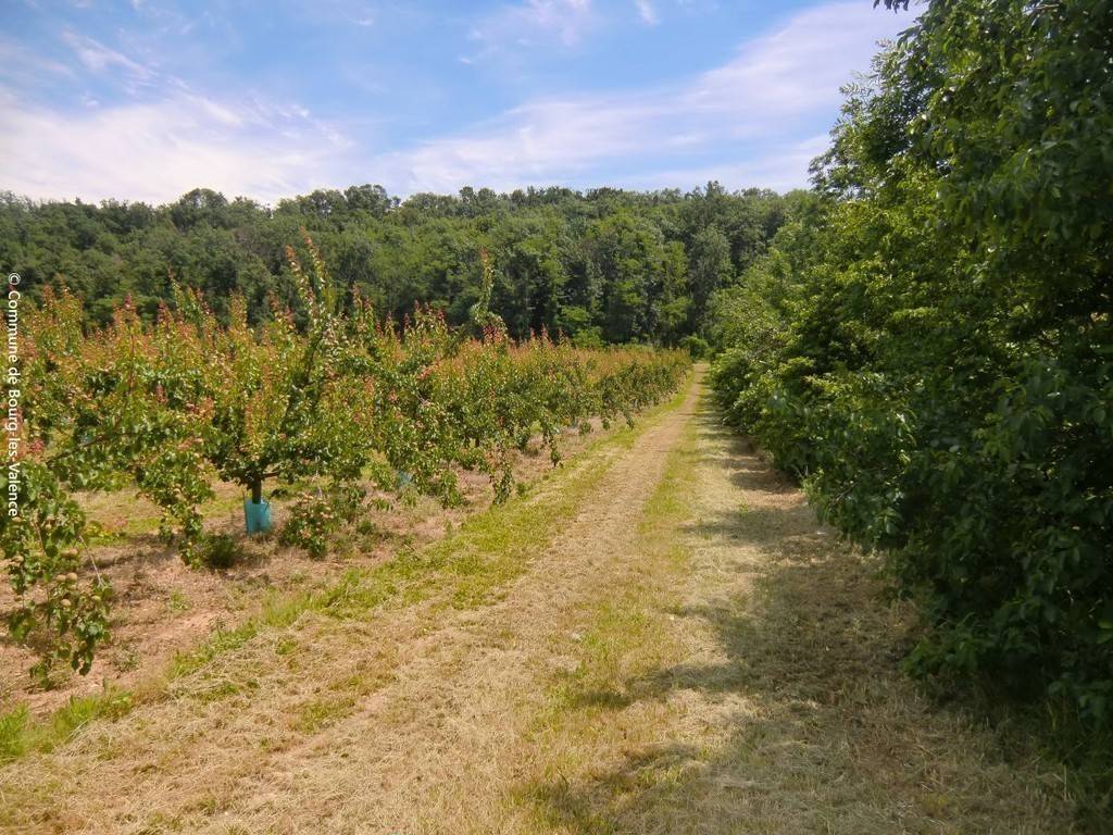
Located in the immediate vicinity of Valence, this hike allows you to discover the surrounding countryside through orchards and shady rural paths, offering beautiful views of the Monts du Matin.
Accessible from Valence by public transport.
How to get there:
- Take Citéa line 20 from Pôle Bus Valence (towards Châteauneuf).
- Get off at the "Cimetière de Talavard" stop in Bourg-lès-Valence, where the walk begins.
La Ferme de GENAS
Proches du quartier des Chanalets et de son château construit au XVIIe siècle, ces bâtiments de ferme s’inscrivent dans un paysage agricole de vergers : pêchers, cerisiers, abricotiers, ressources importantes de la plaine de Valence. On distingue une tour correspondant à une ancienne maison forte construite au XVIe siècle. Elle appartenait à la riche famille Genas, également propriétaire de la maison Dupré-Latour à Valence. Cette famille avait fait fortune dans le commerce du sel, capital dans l’économie domestique. Issus de l’érosion des massifs alpins lors des phases glaciaires du quaternaire, les galets du Rhône ont servi de matériaux de construction, notamment pour les murs de la chapelle privée toute proche et des hameaux environnants.
1/ Du parking, prendre la route en direction de l’Allet. Au 1er giratoire de forme ovale, prendre à gauche la petite route du Chemin de l’Allet. Poursuivre à droite sur le chemin herbeux qui longe la voie rapide, contourne le champ et remonter sur la route. Traverser et reprendre à gauche le chemin qui longe la voie rapide. Remonter sur la route par un escalier en rondins de bois et franchir le pont sur la N7.
Coordonnées: (44.9612832, 4.9016389)
Distance depuis le point de départ: 22 m
2/ Continuer tout droit puis traverser la route suivante pour emprunter un sentier qui suit la route de Fouillouse
Coordonnées: (44.9644732, 4.915688)
Distance depuis le point de départ: 2 km
3/ Au panneau : « ACCA de Châteauneuf sur Isère » avant le hameau de Fouillouse, tourner à gauche sur la piste du chemin de Sapière qui longe les champs, contourne les serres et rejoint la route du Prat. La suivre à gauche jusqu’au hameau du Prat.
Coordonnées: (44.983918, 4.9292903)
Distance depuis le point de départ: 4 km
4/ A la sortie du hameau, prendre à droite un chemin qui contourne les prairies et descend en sous- bois. Aux jalons en ciment, suivre le sentier qui descend jusqu’aux vergers, les longer sur la droite, puis à gauche le long d’une haie pour rejoindre la route de Bourg à hauteur du hameau des Chaux. La suivre sur la gauche.
Coordonnées: (44.9860153, 4.9106924)
Distance depuis le point de départ: 6 km
5/ Aux prochaines maisons, quitter la route et emprunter un chemin sur la gauche entre les champs et les arbres fruitiers qui débouche sur une route. La suivre le long du sentier sécurisé, traverser le giratoire et poursuivre le sentier le long d’une haie, à l’embranchement de la route du golf continuer sur le sentier derrière la haie.
Coordonnées: (44.9860458, 4.9038811)
Distance depuis le point de départ: 7 km
All year round daily.
Free access.