Le sentier des digues
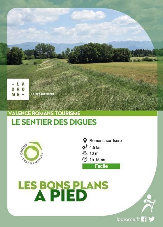
Le sentier des digues
Address
chemin du Harras
26100 ROMANS-SUR-ISÈRE
Contact
Languages spoken
- French
chemin du Harras
26100 ROMANS-SUR-ISÈRE
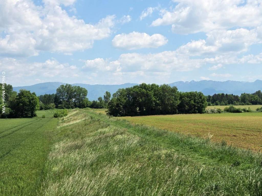
This walk in the immediate vicinity of Romans, will enable you to discover the landscape integration of the Savasse flood protection works, while enjoying the panoramic view of the Vercors.
La Savasse
La Savasse qui s’écoule sur les communes de Peyrins, Mours Saint Eusèbe et Romans sur Isère peut lors de crues inonder les zones habitées de ces communes. En 1993, les débordements de la Savasse ont inondé des dizaines de maisons et causé des dégâts matériels conséquents. Devant la nécessité d’assurer la protection de la population, la Communauté de Communes du Pays de Romans, existante en 2007, s’est engagée dans un vaste chantier de lutte contre les crues de la Savasse. Du pont de Peyrins jusqu’à l’Isère à Romans, les aménagements majeurs pour protéger contre une crue centennale ont consisté à créer 6 champs d’expansion de crues formés par 6 barrages et d’un canal de décharge vers l’Isère. Ces travaux ont été accompagnés de différents sites en restauration écologique : sinuosité de la Savasse, du Béal Rochas, végétalisation étagée et adaptée au cours d’eau, restauration de zones humides, créations de mares. Les différents ouvrages de protection contre les crues se sont bien intégrés au paysage de part leur végétalisation. L’ensemble de ces aménagements a vu toute son efficacité lors de la dernière crue conséquente du 23 octobre 2013. Aujourd’hui, ces ouvrages sont gérés par le service GEMAPI (Gestion milieux aquatiques et prévention des inondations) de Valence Romans Agglo.
1/ Depuis la bande enherbée qui longe le chemin du Haras, à proximité du pont qui enjambe « La petite choranche » emprunter la digue d’Ouest en Est pour arriver chemin de Chaleyre. Pendre à gauche et remonter le cours d’eau.
Coordonnées: (45.0624304, 5.027162)
Distance depuis le point de départ: 4 km
2/ Au croisement de la route des Balmes, continuer tout droit entre le cours d’eau et le champ. A la route du Maupas, continuer tout droit sur un chemin de terre et longer le cours d’eau ; rentrer en sous-bois.
Coordonnées: (45.0666968, 5.0343074)
Distance depuis le point de départ: 1 km
3/ Au pont de pierre, prendre à gauche pour pénétrer dans la forêt pour rattraper le chemin des prés. Continuer jusqu’au croisement et prendre à gauche sur la route du bois de Gaste pour rattraper la route de Maupas. Emprunter la digue qui borde le champ sur la gauche.
Coordonnées: (45.07438, 5.036496)
Distance depuis le point de départ: 2 km
4/ Prendre le sentier de terre à droite juste après la station de pompage, traverser la route pour longer le cours d’eau « La petite Choranche ». Sur la route des Balmes, prendre à droite puis à gauche à l’intersection pour suivre le chemin du Haras avant de franchir un petit pont sur la gauche. Revenir au point de départ en suivant le cours d’eau.
Coordonnées: (45.069652, 5.0325371)
Distance depuis le point de départ: 3 km
All year round daily.
Free of charge.